The temperature in Toronto and the GTA soared to the low 20s for a second day in a row on Tuesday, feeling like 26 with the humidex, but there is a potential for thunderstorms in the region overnight.
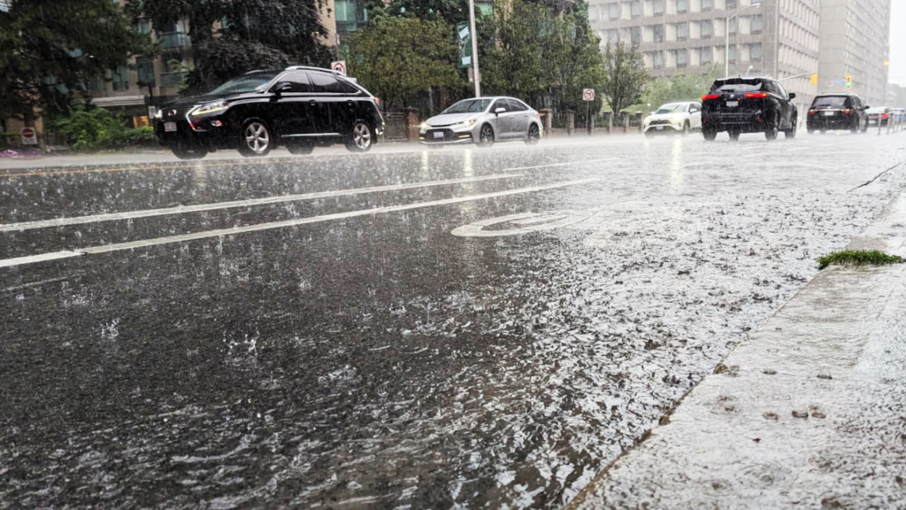
Much of the GTA was under a special weather statement earlier in the day as heavy rain and thunderstorms moved across the region.
According to the latest forecast, more rain is expected later overnight into early Wednesday, along with a risk for thunderstorms and the potential for some localized flooding, as the temperature drops to a low of 8 C.
Heavy downpours will be the greatest risk to these storms for the Greater Toronto and Hamilton Area, however more severe storms are forecast for southwestern Ontario including Windsor. That region could see stronger wind gusts of 80-90 km/h, large hail up to ping-pong ball size along with the risk of a tornado.
Caledon was also under a rainfall warning as total amounts could reach 30 millimetres of rain.
The winds were gusting up to 70 km/h at times this afternoon but will ease this evening.


The Toronto and Region Conservation Authority had warned that all shorelines, rivers, and streams should be considered dangerous, as all this rain may cause rapidly changing water levels and stronger, faster flows in TRCA rivers.
TRCA watersheds have already received varying rainfall over the past 48 hours ranging from 13-30 millimetres, and the TRCA noted that wet ground conditions will reduce the capacity for further infiltration.
GTA temperatures to remain warm until Friday
Some sunny breaks are in store on Wednesday afternoon with the temperature hitting the low 20s once again and a low near 14 C. However, on and off showers are expected to return for the drive home as well as overnight into Thursday morning.
Thursday continues the pattern of above‑seasonal warmth paired with intermittent rainfall and storm risk. Scattered afternoon and evening showers could bring another five to fifteen millimetres of rain, with a high near 20 C and a low of 12 C.
Friday is shaping up to be the driest day of the work week, though a slight chance of morning showers lingers. Overcast conditions are expected to start the day with sunny breaks peeking through in the afternoon. The high will reach about 18 C.
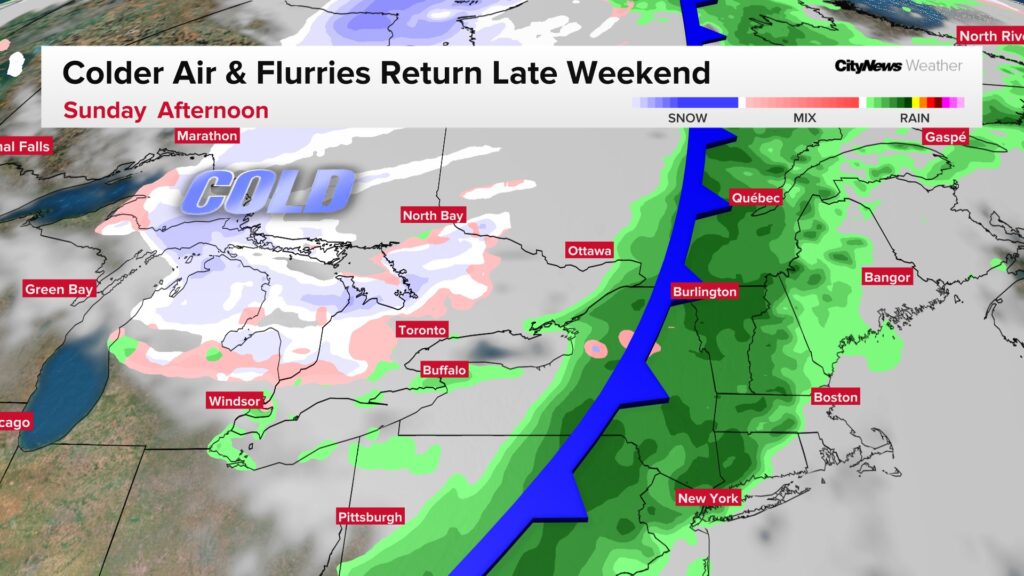
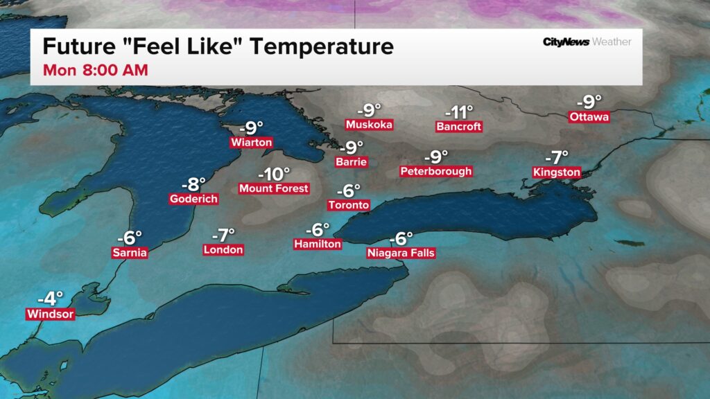
Temperatures are expected to return to seasonal on Saturday with a high of 16 C and then a sharp cool down by Sunday as the mercury drops to 7 C. You can thank a Saturday night cold front passage for this temperature drop, and a return to flurries for the north GTA late Sunday into Monday morning. Both Monday and Tuesday mornings will feature wind chills near -6.

Click here to sign up for the CityNews Weather Guarantee and to check out Toronto’s extended forecast.