It’s the “F” word no one wants to hear in a weather forecast – but with temperatures plunging Wednesday night, frost might be making a comeback.
After some brief relief with daytime temperatures in the mid-to-high teens over the past few days, the GTA is in for another below-seasonal stretch, with a cool start to the day and a high of 13 C that came early in the day Wednesday.
Scattered showers are expected throughout the day, and temperatures drop to seasonable single digits at night. The low is expected to be 4 C Wednesday night, but even colder the next two nights, with a risk of frost.
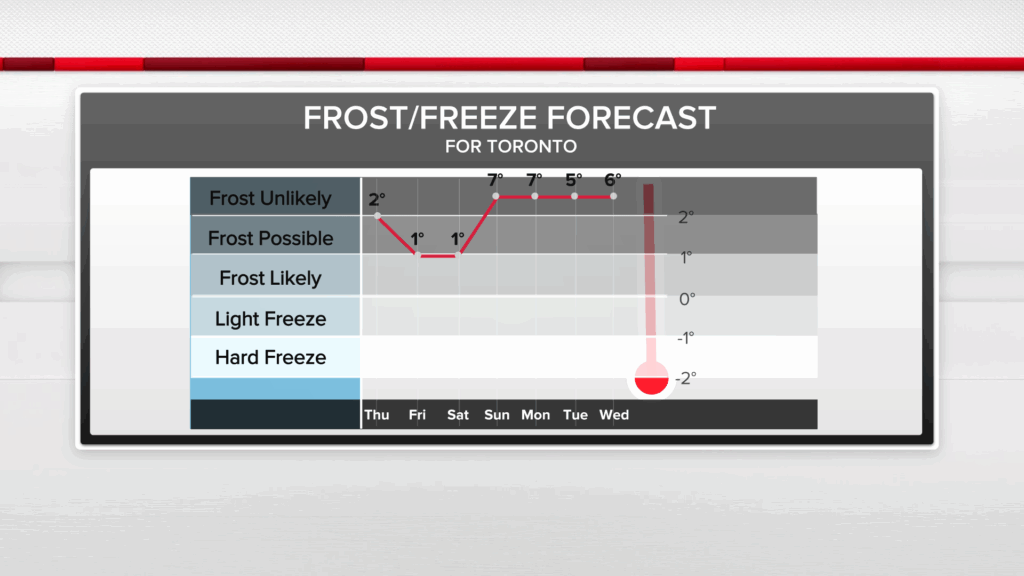
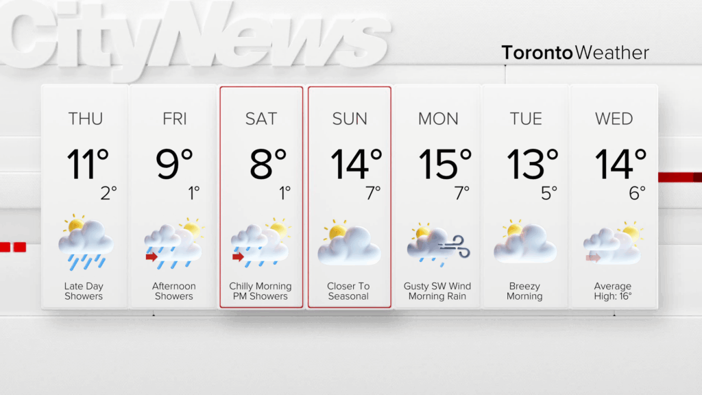
Thursday and Friday remain chilly, with a mix of sun and cloud and a chance of afternoon scattered showers both days. Thursday temperatures will top out at 11 C with a low of 2 C. Friday’s high doesn’t even reach double digits, sitting at 9 C and a low near 1 C, as April’s dismal weather carries over into May.
There’s also some potential for flurries north of Toronto early Friday and Saturday mornings. To add to the misery, you may need some earmuffs or mittens if you’re heading out early Saturday as the wind chill factor is forecast to be between -3 and -5.
If you think it’s been raining a lot, you’d be right. Total rainfall in March was almost 100 milimetres, exceeding the monthly average of 34 milimetres. April followed this wet trend with average monthly rainfall being 71 milimetres, but Pearson recording over 113 milimetres as of April 28th.

The wet pattern continues into the weekend. Saturday will see afternoon showers with a high of 8 C, while Sunday will be relatively dry with a daytime high inching closer to seasonal, at 14 C.
Widespread light rain will start during the day on Sunday and impact the commute on Monday morning, but double-digit temperatures are expected to be more consistent for the rest of the week, although remaining a tad below seasonal.
Click here to sign up for the CityNews Weather Guarantee and to check out Toronto’s extended forecast.