Cottagers and campers from Waterloo Region who enjoy the beaches and nature in the Goderich area might have to get used to tornadoes coming ashore from Lake Huron.
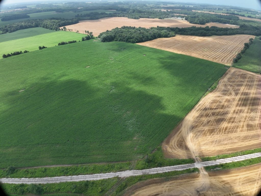
A trio of Saturday night twisters in and around the community has left a path of damage more than six kilometres long, according to the Northern Tornadoes Project.
Dr. Dave Sills, director of Western University’s NTP, told 570 NewsRadio the area of Lake Huron near Goderich has warmed up enough that the water is no longer cold enough to stop tornadoes that form ove the lake.
Sills said the first of the Saturday tornadoes was spotted as a waterspout, around 6:30 p.m., but so far, no damage has been found along the shore.
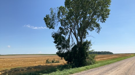
He said the same supercell storm generated a second twister, around 7:00 p.m., that travelled 6.24 kilometres over land, north of Porter’s Hill, with winds up to 125 km/h.
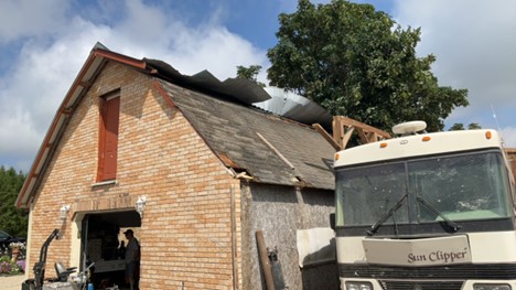
Sills said it was strong enough to bring down trees and, reportedly, push around some RVs at the Shelter Valley Campground.
The third tornado formed around 7:30 p.m., near Harlock, leaving a 4.68-kilometre-long path of damage.
Sills said all three tornadoes have been classified as EF-0 strength, which is the lowest-ranked tornado on the EF (Enhanced Fujita) scale rating.
When asked by 570 NewsRadio if the warming of Lake Huron means cottagers and campers should expect more tornadoes, Sills said, “It used to be a one-off situation…but now we’ve had a couple more of these.”
He added, “You know, it just may be that the southern part of Lake Huron is getting warmed to a temperature now that storms can make it across it without dissipating over the cooler water. So, we may be seeing more of these.”
Sills said, as the lake warms, cold water shutting down the potential for tornadoes “seems to be happening less.”
No injuries were reported from any of the Saturday evening tornadoes.