As residents in Texas continue to battle through devastating flooding, searching for missing loved ones as the death toll rises, questions are now growing over the preparedness of Waterloo Region to battle similar future situations.
It all comes as experts point to increasing temperatures and worsening storms year-over-year, leading to an increase in flood risks, particularly along the Grand River.
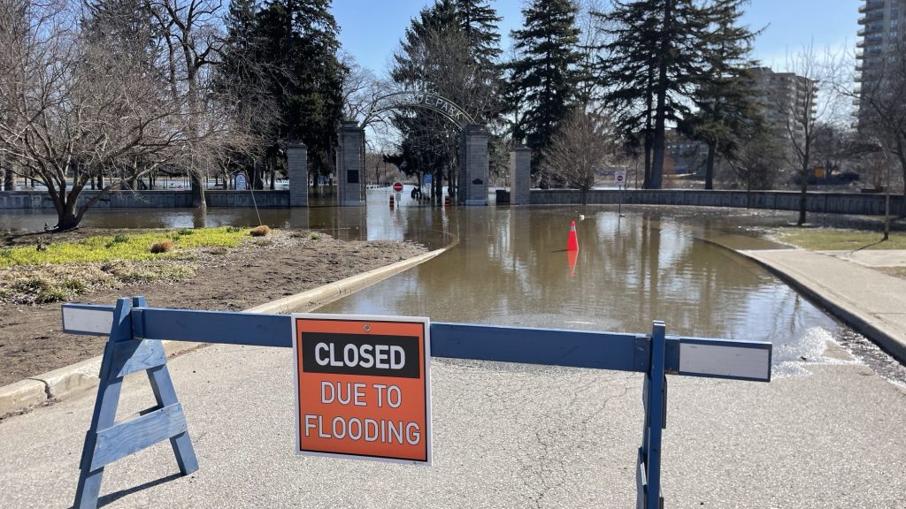
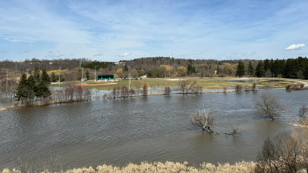
It’s not an overly foreign issue in Waterloo Region, though, as floods have impacted families living along those stretches in previous years.
“I looked out and it was halfway up the front lawn, which was super rare,” said former West Montrose resident, Dee Gow. “That is like spring thaw ice jam kind of levels that we used to get. Then it just kept coming and coming in again.”
Gow said her family had to deal with flooding along the banks of the Grand River in the past, but during the summer months, it can come as more of a surprise compared with other times of the year.
“There was really nowhere to go and no notice, so we lost everything that was below the water level,” mentioned Gow. “Anxiety is probably the smallest word you could use for it. Mother Nature doesn’t mess around.”
Flooding is a problem that has been known to strike various parts of the country throughout the year, with that problem only worsening as of late. It has meant that all levels of government have had to put precautions in place to limit the potential damage if a flash flood does strike.
Kathryn Bakos works as the Managing Director of Finance and Resilience with the University of Waterloo’s Intact Centre on Climate Adaptation, and says Canada is in a good state when it comes to its flood preparedness and precautions.
She mentioned, though, that one key area that still needs improvement country-wide is that of flood risk maps.
“On average across Canada, flood risk maps are 20 to 25 years out of date, meaning we don’t actually know where there is risk in the system,” Bakos stated. “We need to bring those maps up to date so we understand where we are building, where the greatest risk is, so we can actually start putting infrastructure into place to reduce those risks.”
She said that once that step is complete, along with a broader understanding of the at-risk areas across the country, it would open the door would allow huge progress to be made.
“Once we’ve identified where the risk is, then we can start putting in what’s traditionally called gray infrastructure, so flood control systems and structures, dams, berms, diversion channels, cisterns, and holding ponds,” Bakos said. “We need to complement that traditional gray infrastructure with green infrastructure, wetlands, grasslands, and forested areas.”
Clip from Kathryn Bakos, Managing Director of Finance and Resilience with the University of Waterloo’s Intact Centre on Climate Adaptation, discussing Canadian flood preparedness.
While steps are being taken on a larger-scale, Canada-wide level, there are always things to do at a municipal level to help communities more directly.
“We need to be providing constituents with educational materials on ways that homeowners and renters can reduce risk. Importantly, and what we saw in Texas, we need to ensure early warning systems are in place to let people know they should hunker down and stay in place or get to a safe zone.”
With the risks of floods not set to dissipate anytime soon, Bakos said it’s a more important time than ever to make sure families throughout Waterloo Region know what to do if one strikes in their neighbourhoods.
Bakos said that, with flooding now a risk throughout a majority of the year, safety and preparedness should always be the number one concern.
